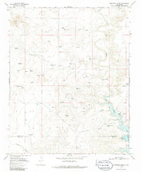
1968 Map of Montesito Creek
USGS Topo · Published 1986About this map
Montesito Sch and the Alamosa Cem sit within a landscape defined by an intricate network of windmills and springs at the edge of the Gravel Hills. This 1968 survey illustrates the critical role of water management in Harding and Quay Counties, where names like Salt Windmill, Division Tank, and Fishpond Tank mark the infrastructure supporting life in the high desert. To the east, Ute Creek winds through the terrain, featuring a Gaging Sta and a Cable Crossing that indicate the practical challenges of traversing the waterway.
Find a feature on this map
44 named features on this map. Tap any name to fly to it.
Don’t see what you’re looking for? This feature index may not catch every label — zoom into the map to look around manually.
Map Details
Editions of this 1968 Montesito Creek Map
2 editions found
Other maps of this area

1930 · Tucumcari
USGS Topo · 1:125,000

1954 · Tucumcari
USGS Topo · 1:250,000

1958 · Tucumcari
USGS Topo · 1:250,000

1962 · Logan
USGS Topo · 1:62,500

1966 · Mc Carty Ranch
USGS Topo · 1:24,000

1968 · Bascom Camp
USGS Topo · 1:24,000

1968 · Hampton Ranch
USGS Topo · 1:24,000

1968 · Hudson
USGS Topo · 1:24,000

1968 · Montesito Creek
USGS Topo · 1:24,000

1969 · Gallegos
USGS Topo · 1:24,000