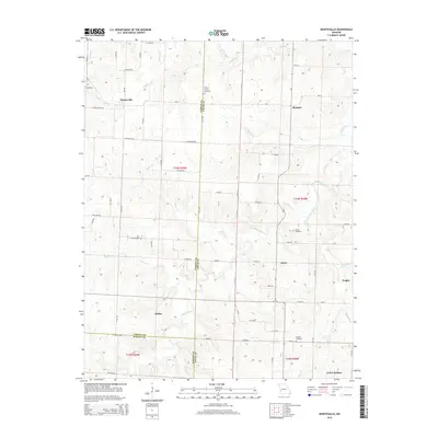
2015 Map of Montevallo
USGS Topo · Published 2015About this map
Montevallo and the surrounding rural landscapes of Vernon, Cedar, and Barton counties are captured here in a period of established agricultural and creek-side settlement. The terrain is defined by a dense network of watercourses, including the westward-flowing Horse Creek and its many tributaries like Bear Cr and Cynthia Cr. These waterways historically dictated the placement of small communities and family burial grounds that remain as vital markers for local historians. Scattered across the section lines are long-standing points of interest such as Zodiac, Osiris, and Olympia, alongside historic resting places including Walnut Grove Cemetery and Brasher Cemetery. In the southern portion of the map, the edge of Jerico Springs appears, anchoring a region where the road grid meticulously follows the Public Land Survey System township and range lines, illustrating the systematic division of the Missouri prairie.
Find a feature on this map
69 named features on this map. Tap any name to fly to it.
Don’t see what you’re looking for? This feature index may not catch every label — zoom into the map to look around manually.
Map Details
Editions of this 2015 Montevallo Map
This is the sole edition of this map. No revisions or reprints were ever made.
Other maps of this area

1886 · Nevada
USGS Topo · 1:125,000

1886 · Stockton
USGS Topo · 1:125,000

1894 · Nevada
USGS Topo · 1:125,000

1939 · Dederick
USGS Topo · 1:24,000

1939 · Filley
USGS Topo · 1:24,000

1939 · Eldorado Springs South
USGS Topo · 1:24,000

1940 · Filley
USGS Topo · 1:24,000
1942 · Dederick
USGS Topo · 1:24,000
1942 · Eldorado Springs South
USGS Topo · 1:24,000

1947 · Joplin
USGS Topo · 1:250,000