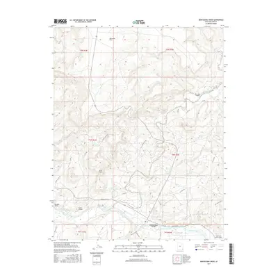
2017 Map of Montezuma Creek
USGS Topo · Published 2017About this map
Montezuma Creek sits at a geographic crossroads in the southeastern Utah desert, where the canyon-carved uplands meet the San Juan River corridor. The settlement is defined by its proximity to the water, with the town center laid out along East Main Street and North 5th East. The surrounding landscape is a complex of mesas and canyons, notably McCracken Mesa to the north and the sharp relief of Gray Ridge and Black Rock Canyon to the east.
Find a feature on this map
39 named features on this map. Tap any name to fly to it.
Don’t see what you’re looking for? This feature index may not catch every label — zoom into the map to look around manually.
Map Details
Editions of this 2017 Montezuma Creek Map
This is the sole edition of this map. No revisions or reprints were ever made.
Other maps of this area

1886 · Abajo
USGS Topo · 1:250,000

1892 · Abajo
USGS Topo · 1:250,000

1893 · Abajo
USGS Topo · 1:250,000

1956 · Cortez
USGS Topo · 1:250,000

1957 · Aneth 1 NW
USGS Topo · 1:24,000

1958 · Cortez
USGS Topo · 1:250,000

1958 · Aneth 1 SW
USGS Topo · 1:24,000

1958 · Cajon Mesa
USGS Topo · 1:62,500

1959 · Cortez
USGS Topo · 1:250,000

1962 · Cortez
USGS Topo · 1:250,000