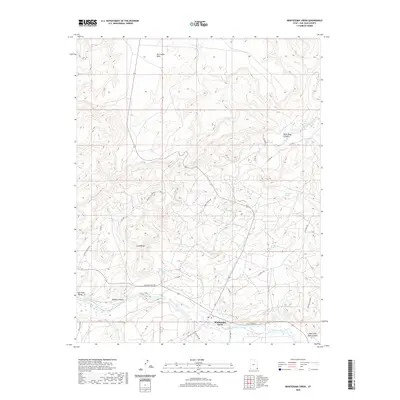
2020 Map of Montezuma Creek
USGS Topo · Published 2020About this map
The San Juan River defines the southern boundary of this high-desert landscape, where the settlement of Montezuma Creek serves as a focal point for the surrounding canyon country. The terrain is a complex series of mesas and drainages, notably McCracken Mesa and Gray Ridge, punctuated by seasonal water sources such as Blueberry Spring and Hot Spring. This 2020 map documents a resilient network of local roads that navigate the vertical geography, including Trading Post Rd and Old Aneth Rd.
Find a feature on this map
34 named features on this map. Tap any name to fly to it.
Don’t see what you’re looking for? This feature index may not catch every label — zoom into the map to look around manually.
Map Details
Editions of this 2020 Montezuma Creek Map
This is the sole edition of this map. No revisions or reprints were ever made.
Other maps of this area

1886 · Abajo
USGS Topo · 1:250,000

1892 · Abajo
USGS Topo · 1:250,000

1893 · Abajo
USGS Topo · 1:250,000

1956 · Cortez
USGS Topo · 1:250,000

1957 · Aneth 1 NW
USGS Topo · 1:24,000

1958 · Cortez
USGS Topo · 1:250,000

1958 · Aneth 1 SW
USGS Topo · 1:24,000

1958 · Cajon Mesa
USGS Topo · 1:62,500

1959 · Cortez
USGS Topo · 1:250,000

1962 · Cortez
USGS Topo · 1:250,000