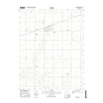
2016 Map of Montezuma
USGS Topo · Published 2016About this map
Montezuma serves as the central hub of this agricultural landscape in Gray County, where the street grid of the town site meets the expansive section lines of the High Plains. The map details the local infrastructure supporting this farming community, including the Montezuma Municipal Airport and the Montezuma Coop Airport, which reflect the region's reliance on aerial support for large-scale agriculture. For genealogists and local historians, several landmarks provide vital points of reference, such as the North Mennonite Cem and Evans Cem. The drainage of Crooked Cr cuts through the southern reaches of the township, providing a break in the geometric road system defined by routes like Aa RD and Co RD 12. The residential core of the town is fully articulated, showing named streets like W Cortez St and E Texcoco St as they extend toward the surrounding fields.
Find a feature on this map
32 named features on this map. Tap any name to fly to it.
Don’t see what you’re looking for? This feature index may not catch every label — zoom into the map to look around manually.
Map Details
Editions of this 2016 Montezuma Map
This is the sole edition of this map. No revisions or reprints were ever made.
Other maps of this area

1892 · Meade
USGS Topo · 1:125,000

1892 · Dodge
USGS Topo · 1:125,000

1896 · Garden
USGS Topo · 1:125,000

1955 · Dodge City
USGS Topo · 1:250,000

1958 · Dodge City
USGS Topo · 1:250,000

1959 · Dodge City
USGS Topo · 1:250,000

1967 · Plains NE
USGS Topo · 1:24,000

1968 · Montezuma
USGS Topo · 1:24,000

1968 · Montezuma NW
USGS Topo · 1:24,000
1968 · Meade NW
USGS Topo · 1:24,000