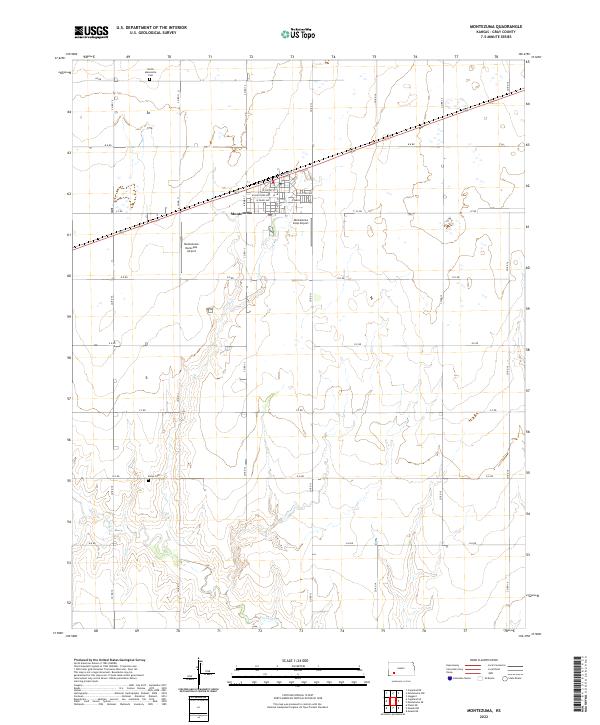
2022 Map of Montezuma
USGS Topo · Published 2022About this map
Montezuma sits at the heart of this Gray County landscape, where the town's street grid—defined by local names like W Cortez St and E Texcoco St—interrupts the expansive section-line road network. The map reveals a community supported by aviation and tradition, noted by the presence of both the Montezuma Municipal Airport and the Montezuma Coop Airport just outside the town center. To the north and south, the North Mennonite Cem and Evans Cem provide clear points of interest for genealogists tracing families in the region. The terrain shifts from the flat agricultural plains in the north to the more dissected drainage patterns of Crooked Cr in the south, illustrating the subtle but important shifts in the local topography that dictated settlement and land use.
Find a feature on this map
33 named features on this map. Tap any name to fly to it.
Don’t see what you’re looking for? This feature index may not catch every label — zoom into the map to look around manually.
Map Details
Editions of this 2022 Montezuma Map
This is the sole edition of this map. No revisions or reprints were ever made.
Other maps of this area

1892 · Meade
USGS Topo · 1:125,000

1892 · Dodge
USGS Topo · 1:125,000

1896 · Garden
USGS Topo · 1:125,000

1955 · Dodge City
USGS Topo · 1:250,000

1958 · Dodge City
USGS Topo · 1:250,000

1959 · Dodge City
USGS Topo · 1:250,000

1967 · Plains NE
USGS Topo · 1:24,000

1968 · Montezuma
USGS Topo · 1:24,000

1968 · Montezuma NW
USGS Topo · 1:24,000
1968 · Meade NW
USGS Topo · 1:24,000