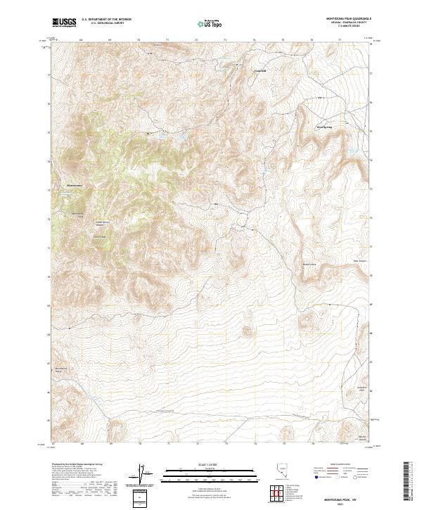
2021 Map of Montezuma Peak
USGS Topo · Published 2021About this map
Montezuma sits at the western edge of a high-desert landscape dominated by the prominent Montezuma Peak and Carroll Peak. This portion of Esmeralda County shows a sparse but deliberate network of water sources essential for survival and industry in the arid basin, including Red Springs, Brickyard Spring, and the colorfully named Dago Joe Spring. The terrain transitions from the high peaks of the Montezuma Range down through Indian Springs Canyon toward the Ralston Desert in the southeast.
Find a feature on this map
27 named features on this map. Tap any name to fly to it.
Don’t see what you’re looking for? This feature index may not catch every label — zoom into the map to look around manually.
Map Details
Editions of this 2021 Montezuma Peak Map
This is the sole edition of this map. No revisions or reprints were ever made.
Other maps of this area

1908 · Lida
USGS Topo · 1:250,000

1913 · Lida
USGS Topo · 1:250,000

1945 · Goldfield
USGS Topo · 1:125,000

1952 · Mud Lake
USGS Topo · 1:62,500

1952 · Goldfield
USGS Topo · 1:62,500

1954 · Goldfield
USGS Topo · 1:250,000

1955 · Goldfield
USGS Topo · 1:250,000

1958 · Goldfield
USGS Topo · 1:250,000

1962 · Goldfield
USGS Topo · 1:250,000
1970 · Montezuma Peak SW
USGS Topo · 1:24,000