
1952 Map of Goldfield
USGS Topo · Published 1958About this map
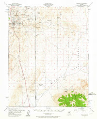
Goldfield and its surrounding mining districts are captured here during the early 1950s, a period when the boom-time infrastructure of the previous decades had begun to yield to modern military land use. The map reveals a high concentration of mineral heritage, from the Columbia Mill ruins to the Silver Pick Mine and Florence Mine, all situated near landmarks like Morena Ridge and Columbia Mtn. The landscape is a study in transition, as the eastern half of the survey is dominated by the sprawling Las Vegas Bombing and Gunnery Range, which overlaps the arid basins of Stonewall Flat. Genealogists and local historians can locate the town Cemetery and various water sources essential to desert survival, including Rabbit Spring and Tognoni Springs. To the south, the settlement at Ralston sits near the Esmeralda and Nye County line, providing a clear view of the transport and extraction networks that once defined this part of Nevada.
Find a feature on this map
41 named features on this map. Tap any name to fly to it.
Don’t see what you’re looking for? This feature index may not catch every label — zoom into the map to look around manually.
Map Details
Editions of this 1952 Goldfield Map
4 editions found
Other maps of this area

1908 · Kawich
USGS Topo · 1:250,000

1908 · Lida
USGS Topo · 1:250,000

1913 · Lida
USGS Topo · 1:250,000

1942 · Tolicha Peak
USGS Topo · 1:125,000

1942 · Cactus Range
USGS Topo · 1:125,000

1945 · Goldfield
USGS Topo · 1:125,000

1952 · Cactus Spring
USGS Topo · 1:62,500

1952 · Mud Lake
USGS Topo · 1:62,500

1952 · Cactus Peak
USGS Topo · 1:62,500

1954 · Goldfield
USGS Topo · 1:250,000