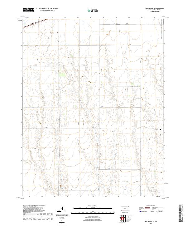
2022 Map of Montezuma SE
USGS Topo · Published 2022About this map
Cave Cem stands as a primary point of historical interest within this section of Gray County, situated in the southeastern corner of the township boundaries. The landscape is defined by the rigid grid of the Public Land Survey System, where townships t28s r27w and t29s r27w meet. This geometric layout is reflected in the local road network, which uses an alphabetical and numerical naming convention such as A A RD and 17 RD. The drainage patterns and topographic contours reveal the subtle draws and rises of the High Plains, providing a clear view of the natural hydrology that influenced early settlement and land use in this part of Kansas.
Find a feature on this map
20 named features on this map. Tap any name to fly to it.
Don’t see what you’re looking for? This feature index may not catch every label — zoom into the map to look around manually.
Map Details
Editions of this 2022 Montezuma SE Map
This is the sole edition of this map. No revisions or reprints were ever made.
Other maps of this area

1892 · Meade
USGS Topo · 1:125,000

1892 · Dodge
USGS Topo · 1:125,000

1955 · Dodge City
USGS Topo · 1:250,000

1958 · Dodge City
USGS Topo · 1:250,000

1959 · Dodge City
USGS Topo · 1:250,000

1968 · Montezuma
USGS Topo · 1:24,000

1968 · Montezuma NW
USGS Topo · 1:24,000
1968 · Meade NW
USGS Topo · 1:24,000

1969 · Meade NE
USGS Topo · 1:24,000
1969 · Fowler
USGS Topo · 1:24,000