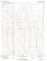
1969 Map of Montezuma SE
USGS Topo · Published 1971About this map
The agricultural landscape of Gray County is defined here by the townships of West Hess and East Hess, where the topography is shaped by gradual drainage patterns toward the south. The Atchison Topeka and Santa Fe railroad cuts across the northern edge of the map, a vital artery for the region's wheat-based economy during the late 1960s. For genealogists and local historians, the Cave Cem in the eastern portion of the survey serves as a primary landmark of early settlement. The map also documents industrial footprints in this rural stretch, including several Gravel Pit locations and an extensive network of pipelines that traverse the section lines, reflecting the modernization of utility infrastructure in western Kansas.
Find a feature on this map
6 named features on this map. Tap any name to fly to it.
Don’t see what you’re looking for? This feature index may not catch every label — zoom into the map to look around manually.
Map Details
Editions of this 1969 Montezuma SE Map
This is the sole edition of this map. No revisions or reprints were ever made.
Other maps of this area

1892 · Meade
USGS Topo · 1:125,000

1892 · Dodge
USGS Topo · 1:125,000

1955 · Dodge City
USGS Topo · 1:250,000

1958 · Dodge City
USGS Topo · 1:250,000

1959 · Dodge City
USGS Topo · 1:250,000

1968 · Montezuma
USGS Topo · 1:24,000

1968 · Montezuma NW
USGS Topo · 1:24,000
1968 · Meade NW
USGS Topo · 1:24,000

1969 · Meade NE
USGS Topo · 1:24,000
1969 · Fowler
USGS Topo · 1:24,000