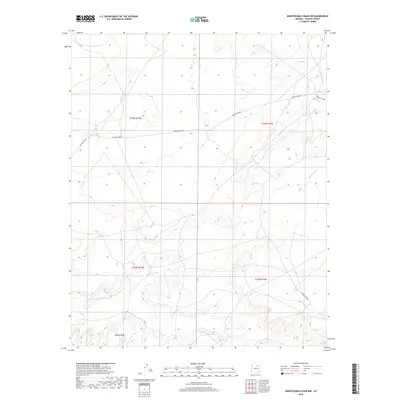
2018 Map of Montezumas Chair NW
USGS Topo · Published 2018About this map
Jeddito Wash and Coyote Wash define the drainage patterns of this high-desert landscape within the Navajo Nation. The terrain is marked by significant topographical relief, where established tribal routes like Indian Rte 6820 and Indian Rte 9901 follow the natural contours of the mesas and valleys. This 2018 survey documents the modern road network and legal boundaries across four distinct townships, including t24n r15e and t23n r16e. The map illustrates how infrastructure in this region of Arizona is dictated by the primary watercourses and the sparse, open environment of the Fort Defiance Agency area.
Find a feature on this map
10 named features on this map. Tap any name to fly to it.
Don’t see what you’re looking for? This feature index may not catch every label — zoom into the map to look around manually.
Map Details
Editions of this 2018 Montezumas Chair NW Map
This is the sole edition of this map. No revisions or reprints were ever made.
Other maps of this area

1883 · Tusayan
USGS Topo · 1:250,000

1886 · Tusayan
USGS Topo · 1:250,000

1947 · Flagstaff
USGS Topo · 1:250,000

1954 · Flagstaff
USGS Topo · 1:250,000

1955 · Leupp
USGS Topo · 1:62,500

1957 · Winslow 1 SW
USGS Topo · 1:24,000
1957 · Winslow 2 SE
USGS Topo · 1:24,000

1958 · Flagstaff
USGS Topo · 1:250,000

1960 · Flagstaff
USGS Topo · 1:250,000

1962 · Flagstaff
USGS Topo · 1:250,000