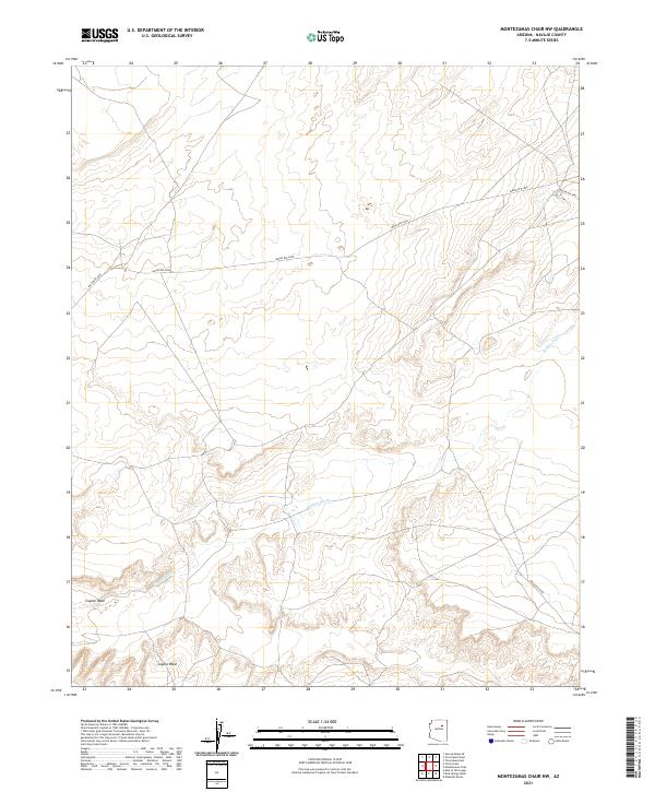
2021 Map of Montezumas Chair NW
USGS Topo · Published 2021About this map
Jeddito Wash and Coyote Wash carve distinct drainage patterns across this Navajo County landscape, defining the topography of the High Desert. The map detail reflects the essential relationship between water and travel in this arid region, where the winding courses of these ephemeral washes dictate the local geography. Human passage is marked by a network of established routes, most notably Indian Rte 6820, which traverses the township lines of t24n r15e and t24n r16e. This 2021 survey provides a contemporary perspective on the land management and infrastructure within the tribal lands of Northeast Arizona, showcasing the intersection of traditional natural landmarks and modern road systems like Indian Rte 9846 and Indian Rte 9901.
Find a feature on this map
9 named features on this map. Tap any name to fly to it.
Don’t see what you’re looking for? This feature index may not catch every label — zoom into the map to look around manually.
Map Details
Editions of this 2021 Montezumas Chair NW Map
This is the sole edition of this map. No revisions or reprints were ever made.
Other maps of this area

1883 · Tusayan
USGS Topo · 1:250,000

1886 · Tusayan
USGS Topo · 1:250,000

1947 · Flagstaff
USGS Topo · 1:250,000

1954 · Flagstaff
USGS Topo · 1:250,000

1955 · Leupp
USGS Topo · 1:62,500

1957 · Winslow 1 SW
USGS Topo · 1:24,000
1957 · Winslow 2 SE
USGS Topo · 1:24,000

1958 · Flagstaff
USGS Topo · 1:250,000

1960 · Flagstaff
USGS Topo · 1:250,000

1962 · Flagstaff
USGS Topo · 1:250,000