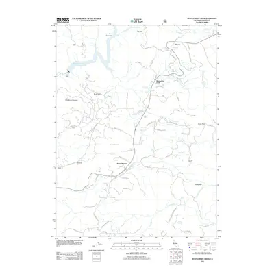
2012 Map of Montgomery Creek
USGS Topo · Published 2012About this map
Montgomery Creek and Hillcrest serve as the primary hubs in this mountainous Shasta County region during the early 21st century. The landscape is defined by the complex drainage systems of the Pit 7 Reservoir, where Hogback Cr meets the main body of water, and the numerous cataracts found in the high terrain to the east, including Hatchet Creek Falls, Lion Slide Falls, and Lion Wash Falls. Local history is preserved in landmarks such as the Halcumb Cem and the Mountain School, while family-named springs like Frank Storey Spring and By Gonney Spring point to long-standing ties to the land.
Find a feature on this map
73 named features on this map. Tap any name to fly to it.
Don’t see what you’re looking for? This feature index may not catch every label — zoom into the map to look around manually.
Map Details
Editions of this 2012 Montgomery Creek Map
This is the sole edition of this map. No revisions or reprints were ever made.
Other maps of this area

1886 · Lassen Peak
USGS Topo · 1:250,000

1890 · Red Bluff
USGS Topo · 1:250,000

1892 · Lassen Peak
USGS Topo · 1:250,000

1894 · Lassen Peak
USGS Topo · 1:250,000

1894 · Red Bluff
USGS Topo · 1:250,000

1901 · Redding
USGS Topo · 1:125,000

1935 · Burney
USGS Topo · 1:96,000

1939 · Burney
USGS Topo · 1:125,000

1949 · Bollibokka Mtn
USGS Topo · 1:62,500

1953 · Millville
USGS Topo · 1:62,500