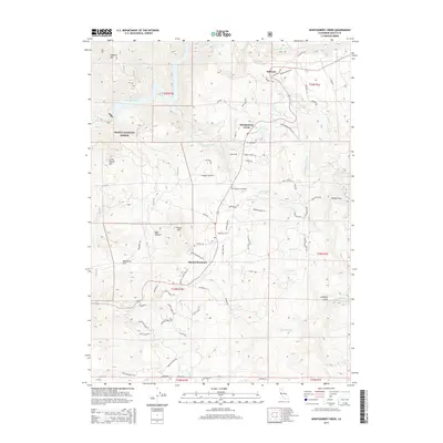
2015 Map of Montgomery Creek
USGS Topo · Published 2015About this map
Montgomery Creek and Round Mountain anchor this Shasta County landscape, where the foothills meet the deep canyons of the Pit River. The region is defined by its complex hydrography, featuring the dramatic Montgomery Creek Falls and the engineered waters of the Pit 7 Reservoir along the western edge. Settlement patterns follow the winding mountain roads, with the community of Hillcrest situated to the north and the Halcumb Cemetery serving as a local landmark in the central valley. Much of the western terrain is protected within the Shasta National Forest, characterized by prominent elevations like Little Round Mtn and the steep descent into Bear Canyon. A network of springs, including Gonney Spring and Moody Spring, sustains the local ecosystem, while named landmarks such as Tolladay Peak and Windy Point provide orientation across the diverse topography of the northern California highlands.
Find a feature on this map
82 named features on this map. Tap any name to fly to it.
Don’t see what you’re looking for? This feature index may not catch every label — zoom into the map to look around manually.
Map Details
Editions of this 2015 Montgomery Creek Map
This is the sole edition of this map. No revisions or reprints were ever made.
Other maps of this area

1886 · Lassen Peak
USGS Topo · 1:250,000

1890 · Red Bluff
USGS Topo · 1:250,000

1892 · Lassen Peak
USGS Topo · 1:250,000

1894 · Lassen Peak
USGS Topo · 1:250,000

1894 · Red Bluff
USGS Topo · 1:250,000

1901 · Redding
USGS Topo · 1:125,000

1935 · Burney
USGS Topo · 1:96,000

1939 · Burney
USGS Topo · 1:125,000

1949 · Bollibokka Mtn
USGS Topo · 1:62,500

1953 · Millville
USGS Topo · 1:62,500