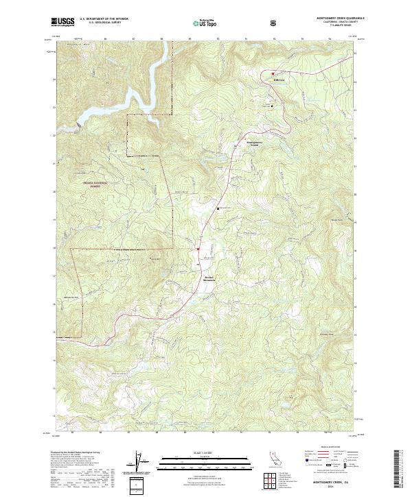
2021 Map of Montgomery Creek
USGS Topo · Published 2021About this map
Montgomery Creek and the settlement of Round Mountain serve as focal points for this portion of the Shasta National Forest in eastern Shasta County. The landscape is defined by the descent from Tolladay Peak and Round Mtn toward the Pit River drainage, which is dominated here by the Pit 7 Reservoir. Local history is preserved in the location of the Hobo Creek Cem and Halcumb Cem, while the industrial and agricultural heritage of the area is noted through labels such as King Mill Rd and Patterson Ranch Rd.
Find a feature on this map
86 named features on this map. Tap any name to fly to it.
Don’t see what you’re looking for? This feature index may not catch every label — zoom into the map to look around manually.
Map Details
Editions of this 2021 Montgomery Creek Map
This is the sole edition of this map. No revisions or reprints were ever made.
Other maps of this area

1886 · Lassen Peak
USGS Topo · 1:250,000

1890 · Red Bluff
USGS Topo · 1:250,000

1892 · Lassen Peak
USGS Topo · 1:250,000

1894 · Lassen Peak
USGS Topo · 1:250,000

1894 · Red Bluff
USGS Topo · 1:250,000

1901 · Redding
USGS Topo · 1:125,000

1935 · Burney
USGS Topo · 1:96,000

1939 · Burney
USGS Topo · 1:125,000

1949 · Bollibokka Mtn
USGS Topo · 1:62,500

1953 · Millville
USGS Topo · 1:62,500