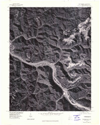
1977 Map of Montgomery
USGS Topo · Published 1980About this map
The Kanawha River carves a deep path through the narrow valley floor in this late 1970s orthophoto, providing a stark visual record of industrial and residential development concentrated along the water. The settlements of Montgomery and Smithers sit directly on the riverbanks, where the flat land is at a premium between the water's edge and the rising slopes. This aerial perspective, prepared in cooperation with the Soil Conservation Service, reveals the intensity of surface disturbance in the surrounding hills, likely indicating the extensive coal mining operations characteristic of this region. To the northwest, Hugheston follows the bend of the river, while Kimberly and Boomer appear as tightly clustered developments in the hollows and along the main transit corridors, illustrating the historical dependence of these communities on the river-and-rail infrastructure of the Kanawha Valley.
Find a feature on this map
6 named features on this map. Tap any name to fly to it.
Don’t see what you’re looking for? This feature index may not catch every label — zoom into the map to look around manually.
Map Details
Editions of this 1977 Montgomery Map
This is the sole edition of this map. No revisions or reprints were ever made.
Other maps of this area

1897 · Kanawha Falls
USGS Topo · 1:125,000

1900 · Kanawha Falls
USGS Topo · 1:125,000

1901 · Kanawha Falls
USGS Topo · 1:125,000

1907 · Clendenin
USGS Topo · 1:62,500

1908 · Clay
USGS Topo · 1:48,000

1908 · Fayetteville
USGS Topo · 1:48,000

1908 · Montgomery
USGS Topo · 1:48,000

1909 · Clendenin
USGS Topo · 1:62,500

1910 · Clay
USGS Topo · 1:62,500

1910 · Fayetteville
USGS Topo · 1:62,500