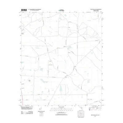
2012 Map of Monticello NE
USGS Topo · Published 2012About this map
Everett and Glasgow anchor this South Georgia landscape near the Florida border, where the terrain is defined by the winding course of the Aucilla River and its network of tributaries like Connell Cr. The area maintains its rural agricultural character, evidenced by numerous plantation-named roads and private airfields such as the Foxfire Plantation Airport. Local family history is preserved in several small burial grounds including Mallette Cem, Little Flock Cem, and Laffittee Cem, which are scattered among the timber tracts and wetlands. Water features are a prominent part of the geography, from the named ponds like Madre Pond to larger basins such as Alagood Lake and Lake Fontaine. The road network, including historic markers like 12 Mile Post Rd and 9 Mile Post Rd, indicates long-standing transit corridors between Monticello and Boston.
Find a feature on this map
50 named features on this map. Tap any name to fly to it.
Don’t see what you’re looking for? This feature index may not catch every label — zoom into the map to look around manually.
Map Details
Editions of this 2012 Monticello NE Map
This is the sole edition of this map. No revisions or reprints were ever made.
Other maps of this area

1954 · Valdosta
USGS Topo · 1:250,000

1956 · Grooverville
USGS Topo · 1:24,000

1956 · Monticello NE
USGS Topo · 1:24,000

1956 · Metcalf
USGS Topo · 1:24,000

1957 · Thomasville
USGS Topo · 1:62,500

1958 · Valdosta
USGS Topo · 1:250,000

1959 · Valdosta
USGS Topo · 1:250,000

1961 · Quitman
USGS Topo · 1:62,500

1962 · Ashville
USGS Topo · 1:24,000
1963 · Lake Miccosukee
USGS Topo · 1:24,000