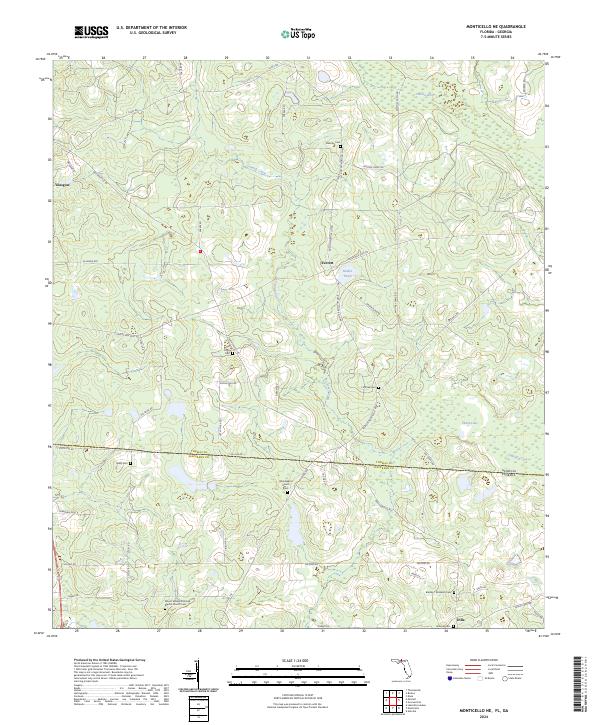
2024 Map of Monticello NE
USGS Topo · Published 2024About this map
The Georgia-Florida state line bisects this landscape, where the northern reaches of Jefferson County meet Thomas County in Georgia. This rural borderland is characterized by a dense network of family and community landmarks, particularly evident in the concentration of burial grounds such as Laffittee Cem and Mallette Cem. The Aucilla River flows through the northeastern corner, anchoring a drainage system that includes Connell Creek and several small water bodies like Madre Pond and Linton Lake.
Find a feature on this map
57 named features on this map. Tap any name to fly to it.
Don’t see what you’re looking for? This feature index may not catch every label — zoom into the map to look around manually.
Map Details
Editions of this 2024 Monticello NE Map
This is the sole edition of this map. No revisions or reprints were ever made.
Other maps of this area

1954 · Valdosta
USGS Topo · 1:250,000

1956 · Grooverville
USGS Topo · 1:24,000

1956 · Monticello NE
USGS Topo · 1:24,000

1956 · Metcalf
USGS Topo · 1:24,000

1957 · Thomasville
USGS Topo · 1:62,500

1958 · Valdosta
USGS Topo · 1:250,000

1959 · Valdosta
USGS Topo · 1:250,000

1961 · Quitman
USGS Topo · 1:62,500

1962 · Ashville
USGS Topo · 1:24,000
1963 · Lake Miccosukee
USGS Topo · 1:24,000