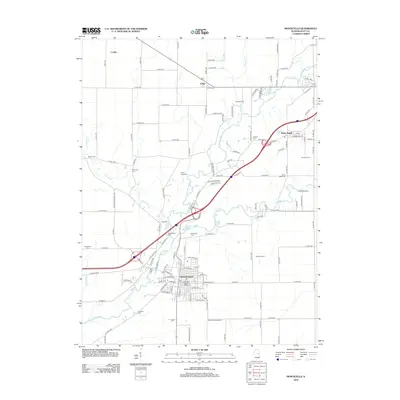
2012 Map of Monticello
USGS Topo · Published 2012About this map
The Sangamon River carves a winding path through the center of this Piatt County landscape, anchoring the settlement of Monticello and the nearby village of White Heath. The river corridor is flanked by several small, historically significant burial grounds including Woolington Cem, Bucks Pond Cem, and Haneline Cem, which offer specific points of interest for genealogists tracing early families in the region. North of the primary settlement, the small communities of Lodge and Combs are situated among a rectilinear grid of county roads, illustrating the enduring agricultural organization of the Illinois prairie. This survey also records modern infrastructure such as the Piatt County Airport and the Monticello Water Works, providing a detailed view of the county seat's development and its relationship with the surrounding rural townships.
Find a feature on this map
126 named features on this map. Tap any name to fly to it.
Don’t see what you’re looking for? This feature index may not catch every label — zoom into the map to look around manually.
Map Details
Editions of this 2012 Monticello Map
This is the sole edition of this map. No revisions or reprints were ever made.
Other maps of this area

1907 · Mahomet
USGS Topo · 1:62,500

1937 · Monticello
USGS Topo · 1:48,000

1943 · Monticello
USGS Topo · 1:62,500

1950 · Tuscola
USGS Topo · 1:62,500

1955 · Bement
USGS Topo · 1:62,500

1957 · Mahomet
USGS Topo · 1:62,500

1958 · Peoria
USGS Topo · 1:250,000

1958 · Decatur
USGS Topo · 1:250,000

1961 · Peoria
USGS Topo · 1:250,000

1961 · Decatur
USGS Topo · 1:250,000