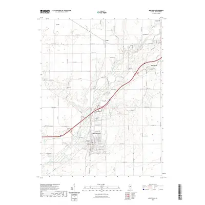
2021 Map of Monticello
USGS Topo · Published 2021About this map
The Sangamon River meanders through this portion of Piatt County, defining the landscape around the city of Monticello and the village of White Heath. This area reflects a long-established agricultural and civic history, anchored by the Piatt County Courthouse in the heart of the county seat. The map reveals an intricate network of rural routes such as Co Hwy 18 and Old Rte 47, connecting smaller settlements like Lodge, Combs, and Centerville.
Find a feature on this map
109 named features on this map. Tap any name to fly to it.
Don’t see what you’re looking for? This feature index may not catch every label — zoom into the map to look around manually.
Map Details
Editions of this 2021 Monticello Map
This is the sole edition of this map. No revisions or reprints were ever made.
Other maps of this area

1907 · Mahomet
USGS Topo · 1:62,500

1937 · Monticello
USGS Topo · 1:48,000

1943 · Monticello
USGS Topo · 1:62,500

1950 · Tuscola
USGS Topo · 1:62,500

1955 · Bement
USGS Topo · 1:62,500

1957 · Mahomet
USGS Topo · 1:62,500

1958 · Peoria
USGS Topo · 1:250,000

1958 · Decatur
USGS Topo · 1:250,000

1961 · Peoria
USGS Topo · 1:250,000

1961 · Decatur
USGS Topo · 1:250,000