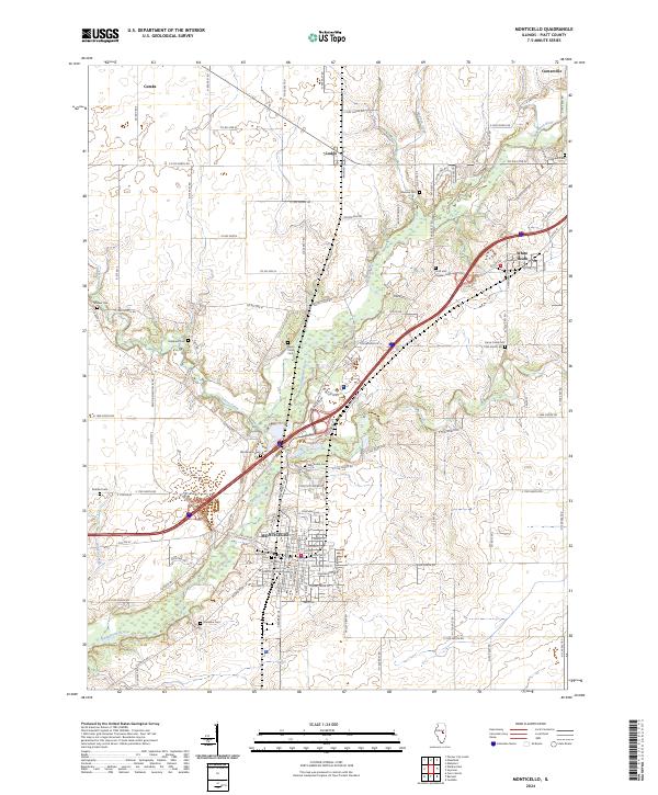
2024 Map of Monticello
USGS Topo · Published 2024About this map
The Monticello area serves as a central hub of Piatt County, centered on the historic Piatt County Courthouse and its surrounding street grid. The landscape is defined by the winding course of the Sangamon River, which flows southwest through the township, joined by tributaries including Goose Creek and Madden Creek. Small unincorporated communities like Lodge, Centerville, and White Heath dot the outlying agricultural fields, connected by a dense network of county roads. For those researching local history, the map provides precise locations for numerous burial sites, from the prominent Monticello Cem near town to the more remote Ross and Hughes Cem and Haneline Cem. The concentration of rural cemeteries, such as Marquiss Cem and Morain Cem, reflects the long-standing family settlements that have occupied these river valleys for generations.
Find a feature on this map
117 named features on this map. Tap any name to fly to it.
Don’t see what you’re looking for? This feature index may not catch every label — zoom into the map to look around manually.
Map Details
Editions of this 2024 Monticello Map
This is the sole edition of this map. No revisions or reprints were ever made.
Other maps of this area

1907 · Mahomet
USGS Topo · 1:62,500

1937 · Monticello
USGS Topo · 1:48,000

1943 · Monticello
USGS Topo · 1:62,500

1950 · Tuscola
USGS Topo · 1:62,500

1955 · Bement
USGS Topo · 1:62,500

1957 · Mahomet
USGS Topo · 1:62,500

1958 · Peoria
USGS Topo · 1:250,000

1958 · Decatur
USGS Topo · 1:250,000

1961 · Peoria
USGS Topo · 1:250,000

1961 · Decatur
USGS Topo · 1:250,000