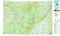
1986 Map of Monticello
USGS Topo · Published 1989About this map
The Catskill Mountains and Shawangunk Mountains dominate this mid-1980s mid-Hudson region survey, illustrating the significant infrastructure required to manage the area's geography and resources. A complex network of water management features, including the massive Ashokan Reservoir, Neversink Reservoir, and Rondout Reservoir, is interspersed with protected lands such as Minnewaska State Park and the Sundown Wild Forest. The region's transport evolution is evident in the transition from the rail-dependent era to a modern highway network, though the path of the New York Ontario and Western RR (Abandoned) remains a visible trace across the landscape near Wurtsboro. Institutional presence is marked by the Wallkill Correctional Facility and the Woodbourne Correctional Institute, reflecting the area's diverse land use. From the busy Hudson River corridor near Kingston and Newburgh to the peaks of Slide Mtn, the map details a region balancing environmental preservation with industrial and civil development.
Find a feature on this map
188 named features on this map. Tap any name to fly to it.
Don’t see what you’re looking for? This feature index may not catch every label — zoom into the map to look around manually.
Map Details
Editions of this 1986 Monticello Map
2 editions found
Other maps of this area

1892 · West Point
USGS Topo · 1:62,500

1892 · Kaaterskill
USGS Topo · 1:62,500

1893 · Kaaterskill
USGS Topo · 1:62,500

1893 · Poughkeepsie
USGS Topo · 1:62,500

1894 · West Point
USGS Topo · 1:62,500

1894 · Kaaterskill
USGS Topo · 1:62,500

1894 · Poughkeepsie
USGS Topo · 1:62,500

1895 · Catskill
USGS Topo · 1:62,500

1898 · Rhinebeck
USGS Topo · 1:62,500

1899 · Kaaterskill
USGS Topo · 1:62,500