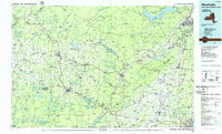
1986 Map of Monticello
USGS Topo · Published 1986About this map
The Catskill Mountains and Shawangunk Mountains dominate this mid-1980s look at the intersection of Sullivan, Ulster, and Orange counties. The landscape is defined by the massive engineering of the New York City water supply system, featuring the Ashokan Reservoir, Rondout Reservoir, and Neversink Reservoir. These bodies of water are joined by smaller reservoirs like Swinging Bridge Reservoir and the Toronto Reservoir, illustrating the mid-century transformation of the region's watersheds into a critical utility network.
Find a feature on this map
123 named features on this map. Tap any name to fly to it.
Don’t see what you’re looking for? This feature index may not catch every label — zoom into the map to look around manually.
Map Details
Editions of this 1986 Monticello Map
2 editions found
Other maps of this area

1892 · West Point
USGS Topo · 1:62,500

1892 · Kaaterskill
USGS Topo · 1:62,500

1893 · Kaaterskill
USGS Topo · 1:62,500

1893 · Poughkeepsie
USGS Topo · 1:62,500

1894 · West Point
USGS Topo · 1:62,500

1894 · Kaaterskill
USGS Topo · 1:62,500

1894 · Poughkeepsie
USGS Topo · 1:62,500

1895 · Catskill
USGS Topo · 1:62,500

1898 · Rhinebeck
USGS Topo · 1:62,500

1899 · Kaaterskill
USGS Topo · 1:62,500