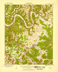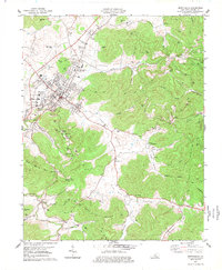
1977 Map of Monticello
USGS Topo · Published 1977About this map
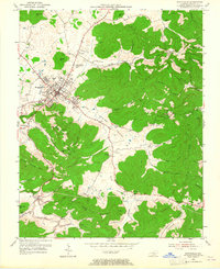
Monticello serves as the central hub of this mid-1970s landscape, where the town’s residential and industrial footprint sits against the rising terrain of Buster Hill and the Elk Ridge. This era shows a community in transition, balancing established institutions like the Vocational Sch and several County Schools with newer developments such as the Wayne County Airport and a Drive-in Theater. The surrounding countryside is deeply etched with hollows and ridges, many bearing family and local names like Wright Hollow and Sulphur Spring Mtn.
Find a feature on this map
65 named features on this map. Tap any name to fly to it.
Don’t see what you’re looking for? This feature index may not catch every label — zoom into the map to look around manually.
Map Details
Editions of this 1977 Monticello Map
This is the sole edition of this map. No revisions or reprints were ever made.
Historical Maps of Monticello Through Time
9 maps found