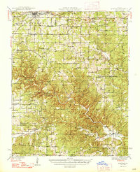
1948 Map of Montier
USGS Topo · Published 1948About this map
Mountain View serves as the primary hub at the northern edge of this Ozark plateau landscape, where the St Louis San Francisco railroad dictates the local economy and movement. Moving south, the terrain becomes increasingly complex as the Eleven Point River and its various tributaries, including the Middle Fork and Barren Fork, carve deep into the countryside. This drainage system is punctuated by significant hydrological features like Blowing Springs, Big Mouth Cave, and Bill Mac Spring.
Find a feature on this map
66 named features on this map. Tap any name to fly to it.
Don’t see what you’re looking for? This feature index may not catch every label — zoom into the map to look around manually.
Map Details
Editions of this 1948 Montier Map
2 editions found

Other maps of this area

1915 · Eminence
USGS Topo · 1:62,500

1917 · Eminence
USGS Topo · 1:62,500

1931 · Bandyville
USGS Topo · 1:48,000

1938 · West Plains
USGS Topo · 1:24,000

1940 · West Plains
USGS Topo · 1:24,000

1943 · Thayer
USGS Topo · 1:62,500

1944 · West Plains
USGS Topo · 1:62,500

1944 · Couch
USGS Topo · 1:62,500

1944 · Birch Tree
USGS Topo · 1:62,500

1945 · Willow Springs
USGS Topo · 1:62,500