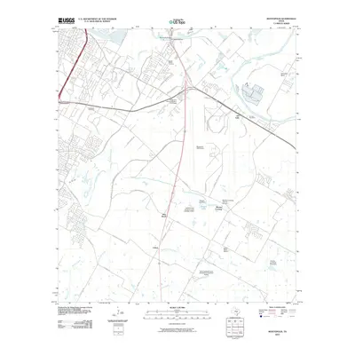
2010 Map of Montopolis
USGS Topo · Published 2010About this map
The Colorado River defines the northern reaches of this landscape near Austin, where the historic Montopolis Bridge connects the growing suburban fringe to the riparian bottomlands of Hornsby Bend. To the south, the terrain is shaped by the winding course of Onion Creek and its many tributaries, including Cottonmouth Creek and Marble Creek. This 2010 survey highlights a transition from traditional rural homesteads, such as the Ernest and Anna Gustafson Farmstead, to significant infrastructure projects like the Bergstrom ARS Airport.
Find a feature on this map
74 named features on this map. Tap any name to fly to it.
Don’t see what you’re looking for? This feature index may not catch every label — zoom into the map to look around manually.
Map Details
Editions of this 2010 Montopolis Map
This is the sole edition of this map. No revisions or reprints were ever made.
Other maps of this area

1896 · Austin
USGS Topo · 1:125,000

1897 · Austin
USGS Topo · 1:125,000

1910 · Austin
USGS Topo · 1:125,000

1932 · Mt. Bonnell
USGS Topo · 1:62,500

1954 · Austin East
USGS Topo · 1:24,000

1954 · Austin West
USGS Topo · 1:24,000

1954 · Austin
USGS Topo · 1:250,000

1955 · Montopolis
USGS Topo · 1:24,000

1955 · Oak Hill
USGS Topo · 1:24,000

1955 · Montopolis
USGS Topo · 1:62,500