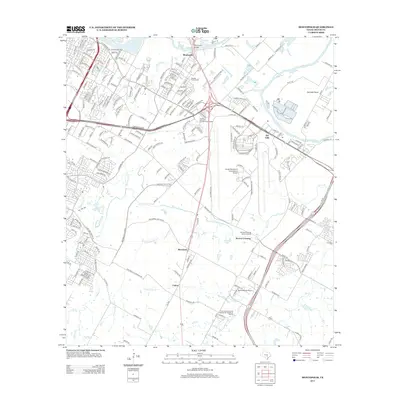
2013 Map of Montopolis
USGS Topo · Published 2013About this map
Montopolis and the surrounding Travis County landscape appear here in 2013, defined by the winding course of the Colorado River and the expanding infrastructure of southeast Austin. The Montopolis Bridge serves as a key crossing point near the historic Burdett Prairie Cem, while the massive footprint of the Austin-Bergstrom International Airport dominates the central portion of the quadrangle. This area represents a complex transition where agricultural heritage, represented by the Ernest and Anna Gustafson Farmstead, meets modern transportation hubs and regional utilities like the Thoroughbred Farms Wastewater Treatment Facility.
Find a feature on this map
36 named features on this map. Tap any name to fly to it.
Don’t see what you’re looking for? This feature index may not catch every label — zoom into the map to look around manually.
Map Details
Editions of this 2013 Montopolis Map
This is the sole edition of this map. No revisions or reprints were ever made.
Other maps of this area

1896 · Austin
USGS Topo · 1:125,000

1897 · Austin
USGS Topo · 1:125,000

1910 · Austin
USGS Topo · 1:125,000

1932 · Mt. Bonnell
USGS Topo · 1:62,500

1954 · Austin East
USGS Topo · 1:24,000

1954 · Austin West
USGS Topo · 1:24,000

1954 · Austin
USGS Topo · 1:250,000

1955 · Montopolis
USGS Topo · 1:24,000

1955 · Oak Hill
USGS Topo · 1:24,000

1955 · Montopolis
USGS Topo · 1:62,500