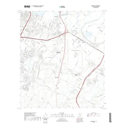
2019 Map of Montopolis
USGS Topo · Published 2019About this map
Montopolis sits at the northern bend of the Colorado River on this contemporary survey of southeastern Austin. The landscape is defined by the convergence of several major water systems, including Lady Bird Lake and the winding Onion Creek corridor. While much of the area is occupied by the modern footprint of the Austin-Bergstrom International Airport, older community markers remain visible. Burdett Prairie and the geological landmark of Pilot Knob anchor the central terrain, while rural settlements like Colton and Moores Crossing appear to the south. Local history is documented through sites such as the Assumption Cem and Burdett Prairie Cem, which persist even as residential developments like those in Del Valle and along S Pleasant Valley Rd expand into the former agricultural lands of southern Travis County.
Find a feature on this map
203 named features on this map. Tap any name to fly to it.
Don’t see what you’re looking for? This feature index may not catch every label — zoom into the map to look around manually.
Map Details
Editions of this 2019 Montopolis Map
This is the sole edition of this map. No revisions or reprints were ever made.
Other maps of this area

1896 · Austin
USGS Topo · 1:125,000

1897 · Austin
USGS Topo · 1:125,000

1910 · Austin
USGS Topo · 1:125,000

1932 · Mt. Bonnell
USGS Topo · 1:62,500

1954 · Austin East
USGS Topo · 1:24,000

1954 · Austin West
USGS Topo · 1:24,000

1954 · Austin
USGS Topo · 1:250,000

1955 · Montopolis
USGS Topo · 1:24,000

1955 · Oak Hill
USGS Topo · 1:24,000

1955 · Montopolis
USGS Topo · 1:62,500