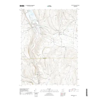
2019 Map of Montour Falls
USGS Topo · Published 2019About this map
Catharine Creek and the Catharine Valley Trail define the central corridor of this region, following the lowlands between the steep rises of Foots Hill and Terry Hill. The landscape illustrates a transition from the marshy margins of Bad Indian Swamp near Watkins Glen to the structured water management systems of the Diversion Channel south of Montour Falls. This engineering, including the Lhommedieu Street Bridge and Mill Street Bridge, highlights the ongoing effort to manage the local hydrology through the narrow valley.
Find a feature on this map
121 named features on this map. Tap any name to fly to it.
Don’t see what you’re looking for? This feature index may not catch every label — zoom into the map to look around manually.
Map Details
Editions of this 2019 Montour Falls Map
This is the sole edition of this map. No revisions or reprints were ever made.
Other maps of this area

1893 · Ithaca
USGS Topo · 1:62,500

1895 · Ithaca
USGS Topo · 1:62,500

1895 · Elmira
USGS Topo · 1:62,500

1898 · Watkins Glen
USGS Topo · 1:62,500

1901 · Watkins
USGS Topo · 1:62,500

1902 · Waverly
USGS Topo · 1:62,500

1905 · Watkins Glen
USGS Topo · 1:125,000

1950 · Elmira
USGS Topo · 1:250,000

1950 · Alpine
USGS Topo · 1:24,000
1950 · Burdett
USGS Topo · 1:24,000