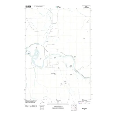
2010 Map of Montour
USGS Topo · Published 2010About this map
Sweet and Montour anchor this detailed study of Gem County's agricultural and riverine landscape, where the Payette River carves a broad valley through the terrain. The map documents a complex system of water management and topography, notably the Gatfield Number Two Dam and the winding course of Church Creek as it feeds into the larger river system. To the north, the settlement of Sweet Valley sits near the Sweet Cemetery, providing a focal point for genealogical research in this rural corridor.
Find a feature on this map
41 named features on this map. Tap any name to fly to it.
Don’t see what you’re looking for? This feature index may not catch every label — zoom into the map to look around manually.
Map Details
Editions of this 2010 Montour Map
This is the sole edition of this map. No revisions or reprints were ever made.
Other maps of this area

1892 · Boise
USGS Topo · 1:125,000

1894 · Squaw Creek
USGS Topo · 1:125,000

1897 · Boise
USGS Topo · 1:125,000

1953 · Banks
USGS Topo · 1:62,500

1953 · Montour
USGS Topo · 1:62,500

1955 · Baker
USGS Topo · 1:250,000

1955 · Boise
USGS Topo · 1:250,000

1957 · Cartwright Canyon
USGS Topo · 1:24,000

1957 · Horseshoe Bend
USGS Topo · 1:24,000

1958 · Boise
USGS Topo · 1:250,000