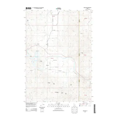
2013 Map of Montour
USGS Topo · Published 2013About this map
Sweet and Montour anchor this section of the Montour Valley, where the landscape transitions from the riparian corridor of the Payette River to the high elevations of South Mtn. The hydrology of the area is dominated by the Black Canyon Reservoir, which collects waters from several drainages including Squaw Creek and Church Cr. Local history is marked by the presence of Roystone Hot Springs, a geothermal feature that has long defined this pocket of Gem County. To the north, the terrain is deeply incised by Wood Canyon and Yergenson Cr, while the southern reaches feature a concentration of named canyons such as Stagecoach Canyon, Baltic Canyon, and Snyder Canyon. Genealogists will find the location of the Sweet Cem preserved near the Sweet Ola Hwy, providing a waypoint for family history research in this agricultural and thermal-spring region.
Find a feature on this map
49 named features on this map. Tap any name to fly to it.
Don’t see what you’re looking for? This feature index may not catch every label — zoom into the map to look around manually.
Map Details
Editions of this 2013 Montour Map
This is the sole edition of this map. No revisions or reprints were ever made.
Other maps of this area

1892 · Boise
USGS Topo · 1:125,000

1894 · Squaw Creek
USGS Topo · 1:125,000

1897 · Boise
USGS Topo · 1:125,000

1953 · Banks
USGS Topo · 1:62,500

1953 · Montour
USGS Topo · 1:62,500

1955 · Baker
USGS Topo · 1:250,000

1955 · Boise
USGS Topo · 1:250,000

1957 · Cartwright Canyon
USGS Topo · 1:24,000

1957 · Horseshoe Bend
USGS Topo · 1:24,000

1958 · Boise
USGS Topo · 1:250,000