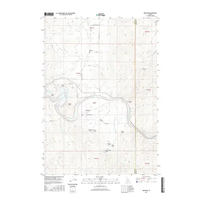
2017 Map of Montour
USGS Topo · Published 2017About this map
Montour Valley and the surrounding agricultural bottomlands are the focal point of this 2017 survey of the Gem County interior. The landscape is defined by the winding Payette River and its entry into the Black Canyon Reservoir, where several drainage systems converge near the Sweet Valley settlement. Local history is anchored by the community of Sweet, with its nearby Sweet Cem, and the historic site of Montour. These settlements lie along the transition between the river flats and the rising elevations of South Mtn. The rugged south-central terrain is deeply incised by a series of geographic landmarks, including Stagecoach Canyon, Baltic Canyon, and Arkansas Canyon, which reflect the area's difficult topography and long-established travel routes. The presence of Roystone Hot Springs north of Squaw Creek further highlights the distinct geothermal character of this river-cut corridor.
Find a feature on this map
50 named features on this map. Tap any name to fly to it.
Don’t see what you’re looking for? This feature index may not catch every label — zoom into the map to look around manually.
Map Details
Editions of this 2017 Montour Map
This is the sole edition of this map. No revisions or reprints were ever made.
Other maps of this area

1892 · Boise
USGS Topo · 1:125,000

1894 · Squaw Creek
USGS Topo · 1:125,000

1897 · Boise
USGS Topo · 1:125,000

1953 · Banks
USGS Topo · 1:62,500

1953 · Montour
USGS Topo · 1:62,500

1955 · Baker
USGS Topo · 1:250,000

1955 · Boise
USGS Topo · 1:250,000

1957 · Cartwright Canyon
USGS Topo · 1:24,000

1957 · Horseshoe Bend
USGS Topo · 1:24,000

1958 · Boise
USGS Topo · 1:250,000