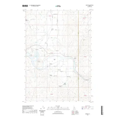
2020 Map of Montour
USGS Topo · Published 2020About this map
Montour Valley serves as the central focal point of this Idaho landscape, where the Payette River enters from the east and feeds into the Black Canyon Reservoir. The small settlements of Sweet and Montour are established near the river's path, connected by the Sweet Ola Hwy. The geography is defined by a dense series of drainages and named canyons, including Stagecoach Canyon, Baltic Canyon, and Arkansas Canyon, which carve through the rising elevations toward South Mtn at the eastern Gem and Boise County line. Local history is anchored at the Sweet Cem and the geothermal Roystone Hot Springs, while prominent terrain features like Regan Butte and Regan Bend mark the transition from the river valley to the surrounding highlands.
Find a feature on this map
49 named features on this map. Tap any name to fly to it.
Don’t see what you’re looking for? This feature index may not catch every label — zoom into the map to look around manually.
Map Details
Editions of this 2020 Montour Map
This is the sole edition of this map. No revisions or reprints were ever made.
Other maps of this area

1892 · Boise
USGS Topo · 1:125,000

1894 · Squaw Creek
USGS Topo · 1:125,000

1897 · Boise
USGS Topo · 1:125,000

1953 · Banks
USGS Topo · 1:62,500

1953 · Montour
USGS Topo · 1:62,500

1955 · Baker
USGS Topo · 1:250,000

1955 · Boise
USGS Topo · 1:250,000

1957 · Cartwright Canyon
USGS Topo · 1:24,000

1957 · Horseshoe Bend
USGS Topo · 1:24,000

1958 · Boise
USGS Topo · 1:250,000