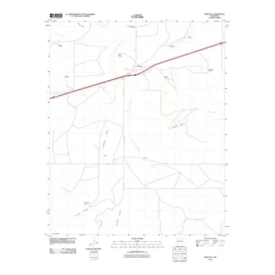
2010 Map of Montoya
USGS Topo · Published 2010About this map
Montoya sits as a primary junction in this high plains landscape of eastern New Mexico, where the infrastructure of the interstate highway corridor meets an expansive network of ranching land. The terrain is defined by dramatic escarpments and watercourses, including the prominent Palomas Mesa and the deep cuts of Captivas Canyon leading toward Captivas Peak. Evidence of the region's cattle-ranching economy is scattered across the quadrangle in the form of numerous named water sources and landmarks like the Alires Windmill, Salt Well Windmill, and Horse Pasture Windmill. Moving south from the rail and road corridor, the landscape transitions into more isolated territory, marked by smaller settlements such as Kirkeed and Randal. These outposts are linked by Quay Road BK, which traverses a landscape drained by several seasonal waterways, most notably Arroyo de las Palomas and Plaza Larga Creek.
Find a feature on this map
24 named features on this map. Tap any name to fly to it.
Don’t see what you’re looking for? This feature index may not catch every label — zoom into the map to look around manually.
Map Details
Editions of this 2010 Montoya Map
This is the sole edition of this map. No revisions or reprints were ever made.
Other maps of this area

1930 · Tucumcari
USGS Topo · 1:125,000

1954 · Santa Fe
USGS Topo · 1:250,000

1954 · Fort Sumner
USGS Topo · 1:250,000

1954 · Tucumcari
USGS Topo · 1:250,000

1954 · Clovis
USGS Topo · 1:250,000

1958 · Fort Sumner
USGS Topo · 1:250,000

1958 · Santa Fe
USGS Topo · 1:250,000

1958 · Clovis
USGS Topo · 1:250,000

1958 · Tucumcari
USGS Topo · 1:250,000

1964 · Muniz Canyon
USGS Topo · 1:24,000