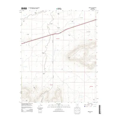
2013 Map of Montoya
USGS Topo · Published 2013About this map
The high desert plains of Quay County are defined by a network of drainage systems and isolated mesas, dominated by the prominent landform of Palomas Mesa. At the crossroads of major transit lines, the settlement of Montoya sits along the interstate corridor, while smaller localities like Kinkeed and Randal are positioned near the rugged breaks of Captivas Canyon. The landscape's agricultural character is evidenced by numerous named water sources and pumping stations, including the Salt Well Windmill, Fish Pond Windmill, and Allres Windmill, which sustain life across the arid flats. To the south, the terrain rises significantly toward Captivas Peak and Luciano Mesa, while the northern portion of the quadrangle is etched by the winding paths of Arroyo de las Palomas and Pajarito Cr.
Find a feature on this map
31 named features on this map. Tap any name to fly to it.
Don’t see what you’re looking for? This feature index may not catch every label — zoom into the map to look around manually.
Map Details
Editions of this 2013 Montoya Map
This is the sole edition of this map. No revisions or reprints were ever made.
Other maps of this area

1930 · Tucumcari
USGS Topo · 1:125,000

1954 · Santa Fe
USGS Topo · 1:250,000

1954 · Fort Sumner
USGS Topo · 1:250,000

1954 · Tucumcari
USGS Topo · 1:250,000

1954 · Clovis
USGS Topo · 1:250,000

1958 · Fort Sumner
USGS Topo · 1:250,000

1958 · Santa Fe
USGS Topo · 1:250,000

1958 · Clovis
USGS Topo · 1:250,000

1958 · Tucumcari
USGS Topo · 1:250,000

1964 · Muniz Canyon
USGS Topo · 1:24,000