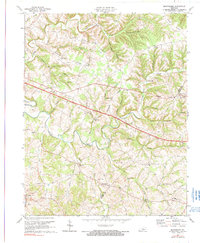
1973 Map of Montpelier
USGS Topo · Published 1990About this map
Russell Creek carves a winding path through the heart of this Adair County landscape, serving as the primary drainage for numerous tributaries like Goose Creek and Cabin Fork. The settlement of Montpelier sits near the southern bend of the creek, surrounded by a dense network of country churches including Pleasant Grove Ch and White Oak Ch. The arrival of the Cumberland Parkway, labeled here as a Toll Road, illustrates the modernization of transport through this rural region during the early 1970s.
Find a feature on this map
59 named features on this map. Tap any name to fly to it.
Don’t see what you’re looking for? This feature index may not catch every label — zoom into the map to look around manually.
Map Details
Editions of this 1973 Montpelier Map
2 editions found
Other maps of this area

1953 · Amandaville
USGS Topo · 1:24,000

1953 · Montpelier
USGS Topo · 1:24,000

1953 · Creelsboro
USGS Topo · 1:24,000

1953 · Jamestown
USGS Topo · 1:24,000

1953 · Dunnville
USGS Topo · 1:24,000

1953 · Cane Valley
USGS Topo · 1:24,000

1954 · Knifley
USGS Topo · 1:24,000

1954 · Columbia
USGS Topo · 1:24,000

1954 · Russell Springs
USGS Topo · 1:24,000

1956 · Corbin
USGS Topo · 1:250,000