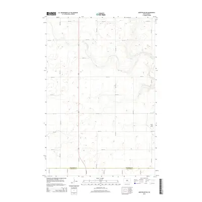
2014 Map of Montpelier NW
USGS Topo · Published 2014About this map
Beaver Creek and its tributary Beaver Cr dominate this prairie landscape along the border of Stutsman and LaMoure Counties. This 2014 survey documents a region characterized by its expansive agricultural grid, defined by numbered section roads like 82nd Ave SE and 46th St SE. The map provides a precise view of the rural infrastructure of the early 21st century, where the land is primarily divided into large-scale farming parcels. A notable landmark in the southeastern portion of the quadrangle is the Liechty Farm Airport, illustrating the integration of aviation into modern agricultural operations. This topographic record is essential for understanding the contemporary drainage patterns and land management of the central North Dakota plains.
Find a feature on this map
20 named features on this map. Tap any name to fly to it.
Don’t see what you’re looking for? This feature index may not catch every label — zoom into the map to look around manually.
Map Details
Editions of this 2014 Montpelier NW Map
This is the sole edition of this map. No revisions or reprints were ever made.
Other maps of this area

1896 · Jamestown
USGS Topo · 1:125,000

1951 · Eldridge SE
USGS Topo · 1:24,000

1952 · Homer
USGS Topo · 1:24,000

1952 · Ypsilanti
USGS Topo · 1:24,000

1953 · Jamestown
USGS Topo · 1:250,000

1953 · Montpelier
USGS Topo · 1:24,000

1953 · Montpelier NW
USGS Topo · 1:24,000

1953 · Adrian
USGS Topo · 1:24,000

1953 · Millarton
USGS Topo · 1:24,000

1953 · Nortonville
USGS Topo · 1:24,000