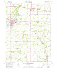
1961 Map of Montpelier
USGS Topo · Published 1973About this map
Montpelier serves as the primary hub in this northwestern Ohio landscape, situated where the St Joseph River and Nettle Creek converge. The town's mid-century character is reflected in the concentration of civic infrastructure, including the High School, Municipal Park, and Riverside Cem. The surrounding townships of Superior and Jefferson maintain a distinct agricultural identity, punctuated by small rural centers like West Jefferson and the Pulaski settlement. Transport evolution is a dominant theme here, with the modern Ohio Turnpike cutting across the northern sections while the tracks of the Norfolk and Western and Penn Central railroads maintain the traditional industrial corridors. Genealogists will find significant value in the numerous family-named landmarks and rural burial sites, such as the Lash Cem and Shiffler Cem, while the Beaver Creek Wildlife Area indicates the preservation of natural drainage basins amidst the cultivated fields.
Find a feature on this map
37 named features on this map. Tap any name to fly to it.
Don’t see what you’re looking for? This feature index may not catch every label — zoom into the map to look around manually.
Map Details
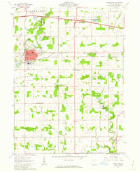
Editions of this 1961 Montpelier Map
2 editions found
Other maps of this area

1907 · Defiance
USGS Topo · 1:62,500

1909 · Defiance
USGS Topo · 1:62,500

1913 · Alvordton
USGS Topo · 1:62,500

1914 · Pioneer
USGS Topo · 1:62,500

1914 · Bryan
USGS Topo · 1:62,500

1943 · Bryan
USGS Topo · 1:62,500

1944 · Pioneer
USGS Topo · 1:62,500

1944 · Alvordton
USGS Topo · 1:62,500

1953 · Fort Wayne
USGS Topo · 1:250,000

1956 · Fort Wayne
USGS Topo · 1:250,000