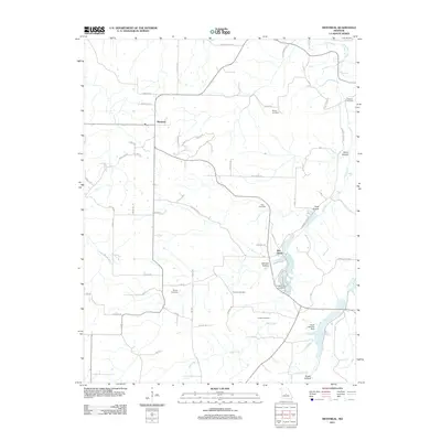
2011 Map of Montreal
USGS Topo · Published 2011About this map
Montreal and Wet Glaize sit at the center of this rural landscape, defined by a network of winding creeks and significant family-owned landmarks. The topography is shaped by the drainage of Wet Glaize Creek, Mill Creek, and Sellars Creek, with numerous hollows like Traw Hollow and Davis Hollow carving through the terrain. A notable concentration of cemeteries, including Sharp Cemetery, Hammer Cemetery, and Knight Cemetery, suggests a long-settled community with deep genealogical roots. The local water systems are managed by features such as the Ozark Fisheries Dam, indicating the importance of local waterways to the area's economy. The road network, including the whimsically named Outlaw Pass and Someday Ln, connects scattered homesteads across a landscape that remains primarily agricultural and residential in character.
Find a feature on this map
50 named features on this map. Tap any name to fly to it.
Don’t see what you’re looking for? This feature index may not catch every label — zoom into the map to look around manually.
Map Details
Editions of this 2011 Montreal Map
This is the sole edition of this map. No revisions or reprints were ever made.
Other maps of this area

1888 · Versailles
USGS Topo · 1:125,000

1888 · Tuscumbia
USGS Topo · 1:125,000

1893 · Versailles
USGS Topo · 1:125,000

1894 · Tuscumbia
USGS Topo · 1:125,000

1932 · Versailles No 4
USGS Topo · 1:48,000

1933 · Stoutland
USGS Topo · 1:62,500

1933 · Iberia
USGS Topo · 1:62,500

1934 · Camdenton
USGS Topo · 1:24,000

1934 · Toronto
USGS Topo · 1:24,000

1937 · Iberia
USGS Topo · 1:62,500