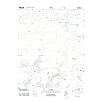
2011 Map of Montreat
USGS Topo · Published 2011About this map
The Asheville Watershed and the protected mountain slopes of the Blue Ridge Pkwy define this high-altitude landscape. The North Fork Swannanoa River flows through the center of the sheet, held back by the North Fork Dam to form a large reservoir. To the south, the community of Montreat is intricately detailed, showing a network of mountain roads such as Virginia Rd and Appalachian Way that wind through the valleys and coves.
Find a feature on this map
140 named features on this map. Tap any name to fly to it.
Don’t see what you’re looking for? This feature index may not catch every label — zoom into the map to look around manually.
Map Details
Editions of this 2011 Montreat Map
This is the sole edition of this map. No revisions or reprints were ever made.
Other maps of this area

1900 · Mount Mitchell
USGS Topo · 1:125,000

1902 · Mount Mitchell
USGS Topo · 1:125,000

1934 · Parts Of Celo And Black Brothers
USGS Topo · 1:24,000

1934 · Parts Of Old Fort and Montreat
USGS Topo · 1:24,000

1935 · Montreat
USGS Topo · 1:24,000

1935 · Black Brothers
USGS Topo · 1:24,000

1935 · Black Mountain
USGS Topo · 1:24,000

1935 · Barnardsville
USGS Topo · 1:24,000

1935 · Craggy Pinnacle
USGS Topo · 1:24,000

1941 · Black Mountain
USGS Topo · 1:24,000