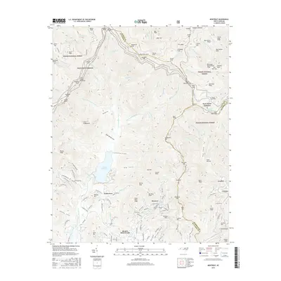
2016 Map of Montreat
USGS Topo · Published 2016About this map
Montreat sits at the base of the Black Mountains in this modern topographic study, where the developed grounds of the Montreat Conf transition into the preserved wildlands of the Pisgah National Forest. The landscape is defined by the steep drainage of the N-Fork Swannanoa River and the high-elevation traverse of the Blue Ridge Parkway, which winds past Clingmans Peak and Mt Gibbes. To the south, the city of Black Mountain anchors the valley, showing a dense network of local streets including Walker Town Rd and McCoy Cove Rd. This map captures the intersection of historical Appalachian settlements like Walkertown and industrial markers such as Graphite and the Jarrett Tunnel, illustrating how the region's transport and utility infrastructure navigates the formidable terrain of the Blue Ridge.
Find a feature on this map
171 named features on this map. Tap any name to fly to it.
Don’t see what you’re looking for? This feature index may not catch every label — zoom into the map to look around manually.
Map Details
Editions of this 2016 Montreat Map
This is the sole edition of this map. No revisions or reprints were ever made.
Other maps of this area

1900 · Mount Mitchell
USGS Topo · 1:125,000

1902 · Mount Mitchell
USGS Topo · 1:125,000

1934 · Parts Of Celo And Black Brothers
USGS Topo · 1:24,000

1934 · Parts Of Old Fort and Montreat
USGS Topo · 1:24,000

1935 · Montreat
USGS Topo · 1:24,000

1935 · Black Brothers
USGS Topo · 1:24,000

1935 · Black Mountain
USGS Topo · 1:24,000

1935 · Barnardsville
USGS Topo · 1:24,000

1935 · Craggy Pinnacle
USGS Topo · 1:24,000

1941 · Black Mountain
USGS Topo · 1:24,000