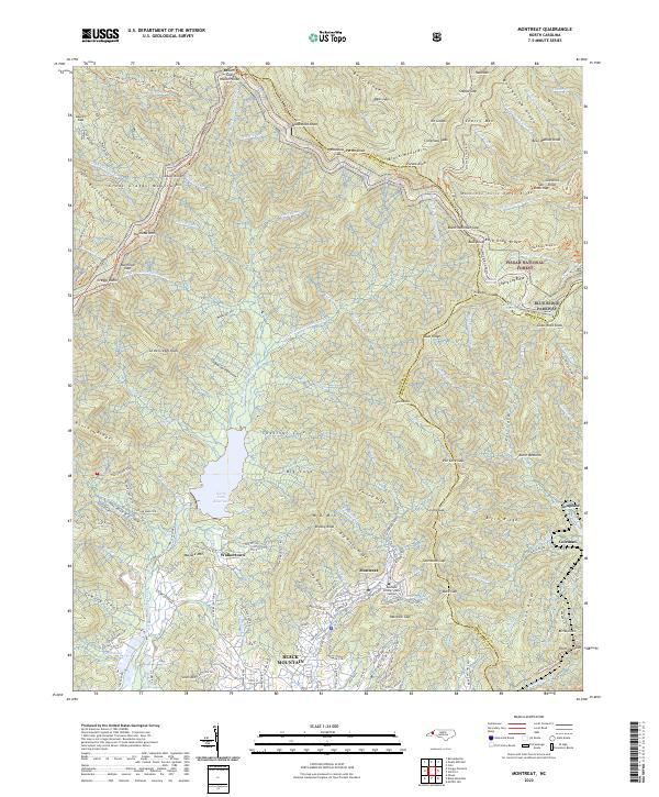
2022 Map of Montreat
USGS Topo · Published 2022About this map
The mountain town of Montreat and its neighboring community of Black Mountain anchor this landscape at the edge of the Pisgah National Forest. The geography is dominated by the steep rises of the Great Craggy Mountains and the Black Mountains, where summits like Clingmans Peak and Craggy Dome define the high ridgelines. Central to the area's hydrology is the North Fork Reservoir, which captures the waters of the N Fork Swannanoa River. Educational history is represented by the Montreat College Main Campus, while the winding Blue Ridge Parkway traverses the crests. Smaller settlements like Walkertown, Graphite, and Coleman appear alongside a network of forest trails, including the Mountains to Sea Trail and the Buncombe Horse Trail, reflecting a modern era of conservation and recreation in the Southern Appalachians.
Find a feature on this map
158 named features on this map. Tap any name to fly to it.
Don’t see what you’re looking for? This feature index may not catch every label — zoom into the map to look around manually.
Map Details
Editions of this 2022 Montreat Map
This is the sole edition of this map. No revisions or reprints were ever made.
Other maps of this area

1900 · Mount Mitchell
USGS Topo · 1:125,000

1902 · Mount Mitchell
USGS Topo · 1:125,000

1934 · Parts Of Celo And Black Brothers
USGS Topo · 1:24,000

1934 · Parts Of Old Fort and Montreat
USGS Topo · 1:24,000

1935 · Montreat
USGS Topo · 1:24,000

1935 · Black Brothers
USGS Topo · 1:24,000

1935 · Black Mountain
USGS Topo · 1:24,000

1935 · Barnardsville
USGS Topo · 1:24,000

1935 · Craggy Pinnacle
USGS Topo · 1:24,000

1941 · Black Mountain
USGS Topo · 1:24,000