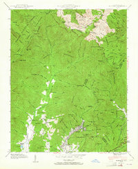
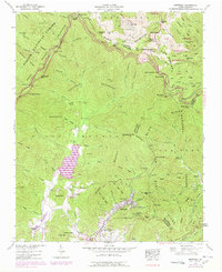
1942 Map of Montreat
USGS Topo · Published 1964About this map
The Asheville Watershed and the massive crests of the Black Mountains dominate this early 1940s landscape. High-altitude summits like Clingmans Peak and Mt Gibbes define the northern boundary, where the Blue Ridge Parkway snakes through gaps and ridges. In the valley below, the planned community of Montreat centers on Lake Susan, serving as a core spiritual and educational hub.
Find a feature on this map
104 named features on this map. Tap any name to fly to it.
Don’t see what you’re looking for? This feature index may not catch every label — zoom into the map to look around manually.
Map Details
Editions of this 1942 Montreat Map
5 editions found
Other maps of this area

1900 · Mount Mitchell
USGS Topo · 1:125,000

1902 · Mount Mitchell
USGS Topo · 1:125,000

1934 · Parts Of Celo And Black Brothers
USGS Topo · 1:24,000

1934 · Parts Of Old Fort and Montreat
USGS Topo · 1:24,000

1935 · Montreat
USGS Topo · 1:24,000

1935 · Black Brothers
USGS Topo · 1:24,000

1935 · Black Mountain
USGS Topo · 1:24,000

1935 · Barnardsville
USGS Topo · 1:24,000

1935 · Craggy Pinnacle
USGS Topo · 1:24,000

1941 · Black Mountain
USGS Topo · 1:24,000