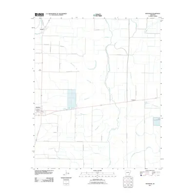
2011 Map of Montrose
USGS Topo · Published 2011About this map
Montrose serves as the primary hub of this Arkansas Delta landscape, where a dense network of drainage canals and natural waterways dictates the layout of agricultural fields. The meandering course of Bayou Bartholomew cuts across the northwest corner near Boydell, while the central and eastern portions of the map are defined by the winding paths of Big Bayou, Wards Bayou, and Crooked Bayou. These watercourses signify the fertile alluvial history of Ashley County, supporting a grid-like system of rural routes such as Ashley Road 58 and Slaughter Rd. Small settlements like Cosgrove and landmarks such as Union Cemetery are spaced along these roads, illustrating the distributed nature of local farmsteads. The inclusion of Lost Lake and various segments of Dry Bayou highlights the complex hydrology of a region deeply tied to its river-and-rail origins and modern agricultural management.
Find a feature on this map
30 named features on this map. Tap any name to fly to it.
Don’t see what you’re looking for? This feature index may not catch every label — zoom into the map to look around manually.
Map Details
Editions of this 2011 Montrose Map
This is the sole edition of this map. No revisions or reprints were ever made.
Other maps of this area

1935 · Mist
USGS Topo · 1:62,500

1935 · Wilmot
USGS Topo · 1:62,500

1936 · Eudora
USGS Topo · 1:62,500

1936 · Lake Village
USGS Topo · 1:62,500

1953 · Greenwood
USGS Topo · 1:250,000

1955 · Lake Village
USGS Topo · 1:62,500

1956 · Greenwood
USGS Topo · 1:250,000

1957 · Eudora
USGS Topo · 1:62,500

1960 · Snyder
USGS Topo · 1:24,000

1960 · Mist
USGS Topo · 1:62,500