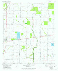
1981 Map of Montrose
USGS Topo · Published 1982About this map
The low-lying delta landscape of Ashley and Chicot counties is defined by an intricate network of slow-moving water, where the Big Bayou and Crooked Bayou meander through flat bottomlands. In the early 1980s, the town of Montrose serves as a local hub, situated at a junction where the Missouri Pacific railroad line intersects with regional highways. The map reveals a transition toward aquaculture, with several large Fish Farm operations established in the wet soils between Wards Bayou and the Old Boeuf River. Genealogists will find several community landmarks, including Union Cem, Shady Grove Cem, and Evergreen Ch near the settlement of Boydell. The presence of numerous wells and flumes throughout the area highlights the ongoing importance of water management for the agricultural economy in this corner of southeast Arkansas.
Find a feature on this map
25 named features on this map. Tap any name to fly to it.
Don’t see what you’re looking for? This feature index may not catch every label — zoom into the map to look around manually.
Map Details
Editions of this 1981 Montrose Map
This is the sole edition of this map. No revisions or reprints were ever made.
Other maps of this area

1935 · Mist
USGS Topo · 1:62,500

1935 · Wilmot
USGS Topo · 1:62,500

1936 · Eudora
USGS Topo · 1:62,500

1936 · Lake Village
USGS Topo · 1:62,500

1953 · Greenwood
USGS Topo · 1:250,000

1955 · Lake Village
USGS Topo · 1:62,500

1956 · Greenwood
USGS Topo · 1:250,000

1957 · Eudora
USGS Topo · 1:62,500

1960 · Snyder
USGS Topo · 1:24,000

1960 · Mist
USGS Topo · 1:62,500