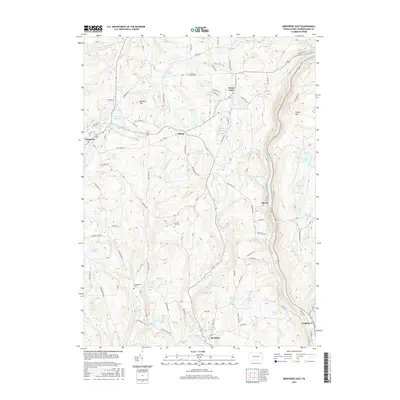
2016 Map of Montrose East
USGS Topo · Published 2016About this map
Lake Montrose and the borough of Montrose anchor the northwestern corner of this landscape, where the headwaters of Snake Cr and Meshoppen Cr begin their descent through the Glaciated Low Plateau. This area is defined by its numerous glacial kettles and ponds, ranging from the cluster at Heart Lake to the tiered waters of Upper Lake, Middle Lake, and Lower Lake in the east.
Find a feature on this map
74 named features on this map. Tap any name to fly to it.
Don’t see what you’re looking for? This feature index may not catch every label — zoom into the map to look around manually.
Map Details
Editions of this 2016 Montrose East Map
This is the sole edition of this map. No revisions or reprints were ever made.
Other maps of this area

1892 · Dundaff
USGS Topo · 1:62,500

1932 · Susquehanna
USGS Topo · 1:62,500

1935 · Susquehanna
USGS Topo · 1:62,500

1943 · Montrose
USGS Topo · 1:62,500

1945 · Montrose
USGS Topo · 1:62,500

1946 · Tunkhannock
USGS Topo · 1:62,500

1946 · Springville
USGS Topo · 1:24,000

1946 · Hop Bottom
USGS Topo · 1:24,000
1946 · Lenoxville
USGS Topo · 1:24,000

1947 · Hopbottom
USGS Topo · 1:24,000