
1956 Map of Montrose
USGS Topo · Published 1963About this map
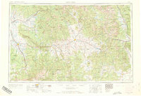
The Gunnison River and its major tributaries anchor this mid-century look at West-Central Colorado, following the transition from the high peaks of the Sawatch Mountains down to the fruit-growing benches of Rogers Mesa. The landscape is dominated by massive public lands, including the Gunnison National Forest and Grand Mesa National Forest, which surround mining hubs and river towns. Of particular note is the Blue Mesa Reservoir, appearing during the era of major water reclamation projects along the Gunnison. The transportation network is defined by the Denver & Rio Grande Western RR, which connects the coal-producing area of Somerset and the silver legacy of Ouray to the wider region. High-elevation settlements like Crested Butte and Gunnison serve as focal points for the ranching and resource extraction economy that shaped the Continental Divide's western slope.
Find a feature on this map
46 named features on this map. Tap any name to fly to it.
Don’t see what you’re looking for? This feature index may not catch every label — zoom into the map to look around manually.
Map Details
Editions of this 1956 Montrose Map
3 editions found
Other maps of this area

1888 · Crested Butte
USGS Topo · 1:62,500

1888 · Anthracite
USGS Topo · 1:62,500

1889 · Crested Butte
USGS Topo · 1:62,500

1889 · Anthracite
USGS Topo · 1:62,500

1889 · Leadville
USGS Topo · 1:125,000

1891 · Leadville
USGS Topo · 1:125,000

1893 · Anthracite
USGS Topo · 1:62,500

1893 · Crested Butte
USGS Topo · 1:62,500

1893 · Aspen
USGS Topo · 1:62,500

1894 · Anthracite
USGS Topo · 1:62,500