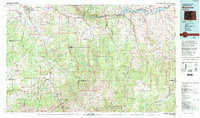
1983 Map of Montrose
USGS Topo · Published 1993About this map
The Uncompahgre River valley serves as the central corridor for this 1980s-era topographic study, anchored by the regional hub of Montrose. To the south, the landscape transforms into the high-alpine terrain of the San Juan Mountains, where a high concentration of mining claims like the Camp Bird Mine, Old Maid Mine, and Revenue Mine define the area around Ouray and Portland. This era shows the developed footprint of the Curecanti National Recreation Area, featuring the massive Blue Mesa Reservoir and the sheer depths of the Black Canyon of the Gunnison. The map documents a complex network of forest access and mountain passes, including the well-known Slumgullion Pass near Lake City. Between the jagged heights of Mount Sneffels and the broad Log Hill Mesa, the map reveals the transition from valley ranching to high-country resource extraction.
Find a feature on this map
79 named features on this map. Tap any name to fly to it.
Don’t see what you’re looking for? This feature index may not catch every label — zoom into the map to look around manually.
Map Details
Editions of this 1983 Montrose Map
2 editions found
Other maps of this area

1897 · Telluride
USGS Topo · 1:62,500

1897 · Silverton
USGS Topo · 1:62,500

1901 · Silverton
USGS Topo · 1:62,500

1902 · Silverton
USGS Topo · 1:62,500

1902 · Ouray
USGS Topo · 1:62,500

1903 · Lake City
USGS Topo · 1:62,500

1904 · Ouray
USGS Topo · 1:62,500

1904 · Telluride
USGS Topo · 1:62,500

1905 · Lake City
USGS Topo · 1:62,500

1905 · San Cristobal
USGS Topo · 1:125,000