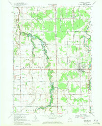
1969 Map of Montrose
USGS Topo · Published 1971About this map
The Misteguay Creek valley defines the landscape of this region as it flows north toward the county line, passing through a patchwork of agricultural fields and small settlements. The village of Montrose serves as the primary population center in the east, situated where the Grand Trunk Western railroad meets the winding path of the Flint River. This survey captures the rural infrastructure of the late 1960s, evidenced by a dense network of family-named roads such as Sigmund Road and Ferden Road, and a collection of local institutions that anchored these farming communities.
Find a feature on this map
68 named features on this map. Tap any name to fly to it.
Don’t see what you’re looking for? This feature index may not catch every label — zoom into the map to look around manually.
Map Details
Editions of this 1969 Montrose Map
2 editions found
Other maps of this area

1917 · Chesaning
USGS Topo · 1:62,500

1917 · St. Charles
USGS Topo · 1:62,500

1919 · Saginaw
USGS Topo · 1:62,500

1919 · Burt
USGS Topo · 1:62,500

1921 · Burt
USGS Topo · 1:62,500

1941 · Saginaw
USGS Topo · 1:62,500

1943 · Burt
USGS Topo · 1:62,500

1943 · Chesaning
USGS Topo · 1:62,500

1943 · Saginaw
USGS Topo · 1:62,500

1943 · St. Charles
USGS Topo · 1:62,500
Featured Places
- Montrose, MI
- Hazelton Township, MI
- Maple Grove Township, MI
- Albee Township, MI
- Flushing Charter Township, MI