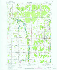
1969 Map of Montrose
USGS Topo · Published 1976About this map
Misteguay Creek meanders through the heart of this agricultural region where the borders of Saginaw, Genesee, and Shiawassee counties meet. In the late 1960s, the landscape was defined by its drainage network and section-line roads, such as Ferden Road and Gary Road, supporting scattered rural communities. The town of Montrose serves as a primary hub, situated near the Flint River and served by the Grand Trunk Western railroad line. Local life is centered around institutions like Maple Grove Sch, St Michaels High Sch, and several country churches including Cook Chapel and the Assembly of God Ch. The map provides a detailed view of the era's rural infrastructure, from the Pewanogowink Landing Strip to the numerous irrigation and drainage features like Bortle Drain and Peart Drain that managed the low-lying terrain.
Find a feature on this map
47 named features on this map. Tap any name to fly to it.
Don’t see what you’re looking for? This feature index may not catch every label — zoom into the map to look around manually.
Map Details
Editions of this 1969 Montrose Map
2 editions found
Other maps of this area

1917 · Chesaning
USGS Topo · 1:62,500

1917 · St. Charles
USGS Topo · 1:62,500

1919 · Saginaw
USGS Topo · 1:62,500

1919 · Burt
USGS Topo · 1:62,500

1921 · Burt
USGS Topo · 1:62,500

1941 · Saginaw
USGS Topo · 1:62,500

1943 · Burt
USGS Topo · 1:62,500

1943 · Chesaning
USGS Topo · 1:62,500

1943 · Saginaw
USGS Topo · 1:62,500

1943 · St. Charles
USGS Topo · 1:62,500
Featured Places
- Montrose, MI
- Hazelton Township, MI
- Maple Grove Township, MI
- Albee Township, MI
- Flushing Charter Township, MI